
April 2, 2026
Earth systems modeling is undergoing a fundamental shift: moving from long-range climate projections into near-term decision support.
As identified by the GESDA Science Breakthrough Radar®, this represents a convergence of climate science, high-performance computing, and real-world application. Rather than simply tracking global trends, these models are increasingly used to inform infrastructure planning, disaster preparedness, and resource management.
This transition is visible in large-scale initiatives like the European Union’s ESM2025 project. Coordinated by Météo-France, the project aims to align climate simulations with the mitigation strategies of the Paris Agreement to limit global temperature rise to well below 2º Celsius. While the European Commission notes that these models already provide an “important scientific basis” for policy, the next frontier lies in increasing their resolution and physical accuracy.
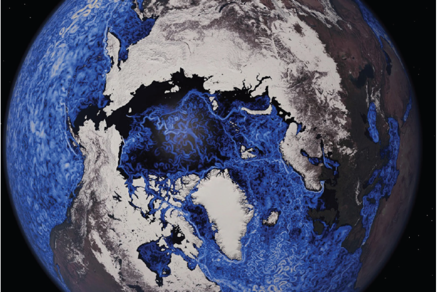
Recent work in Switzerland illustrates this evolution. Researchers at ETH Zurich and the Swiss National Supercomputing Center produced simulations at kilometer-scale resolution. This level of detail allows models to capture local weather events such as intense rainfall directly, rather than relying on the approximations used by earlier generations.
However, higher resolution is only half the battle. A study published in PNAS this March, led by ETH researcher Seulgi Moon, reveals that surface data alone is often insufficient to predict climate risks like landslides. The research highlights how subsurface geological structures dictate groundwater movement.
“Rain falling on a hillside is only part of the story,” said Moon, formerly of UCLA Earth, which used field data from Coos Bay, Oregon. “The critical zone structure below the soil affects how groundwater is stored and redirected during a storm, and that can strongly influence when and where shallow landslides begin. This research adds to our ability to predict landslide susceptibility and the timing of its occurrence, improving early warning and hazard preparedness.”
The gap between surface observation and subsurface reality is a central focus for GESDA. It underscores that modern modeling is no longer just about atmospheric change over decades; it is about integrating surface and subsurface dynamics to manage immediate hazards.
Institutionalizing the Science
In Switzerland, the science is moving rapidly into the institutional realm. ETH Zurich is establishing the Swiss GeoLab in the canton of Lucerne. Funded with 100 million Swiss francs from the Jörg G. Bucherer Foundation, the center integrates satellite data and AI-driven analysis to create operational tools for authorities.
One primary project focuses on early detection of mass movements in the Alps. Verena Griess, an ETH professor and co-director of the center, notes that while individual cantons like Valais and Graubünden already use satellite data, the GeoLab aims to optimize and expand these systems across the entire Swiss Alpine region.
The GeoLab is also designed to translate complex environmental data into operational tools for authorities and industry. “We want to deliver innovative Earth observation solutions to where they are needed and will be most effective. For this, we’re reliant on suitable partners,” said Felix Seidel, managing director of the ETH Swiss Geolab.
Such efforts reflect a broader transition: Earth systems modeling is becoming part of the infrastructure governments rely on to manage risk, rather than remaining confined to research environments.
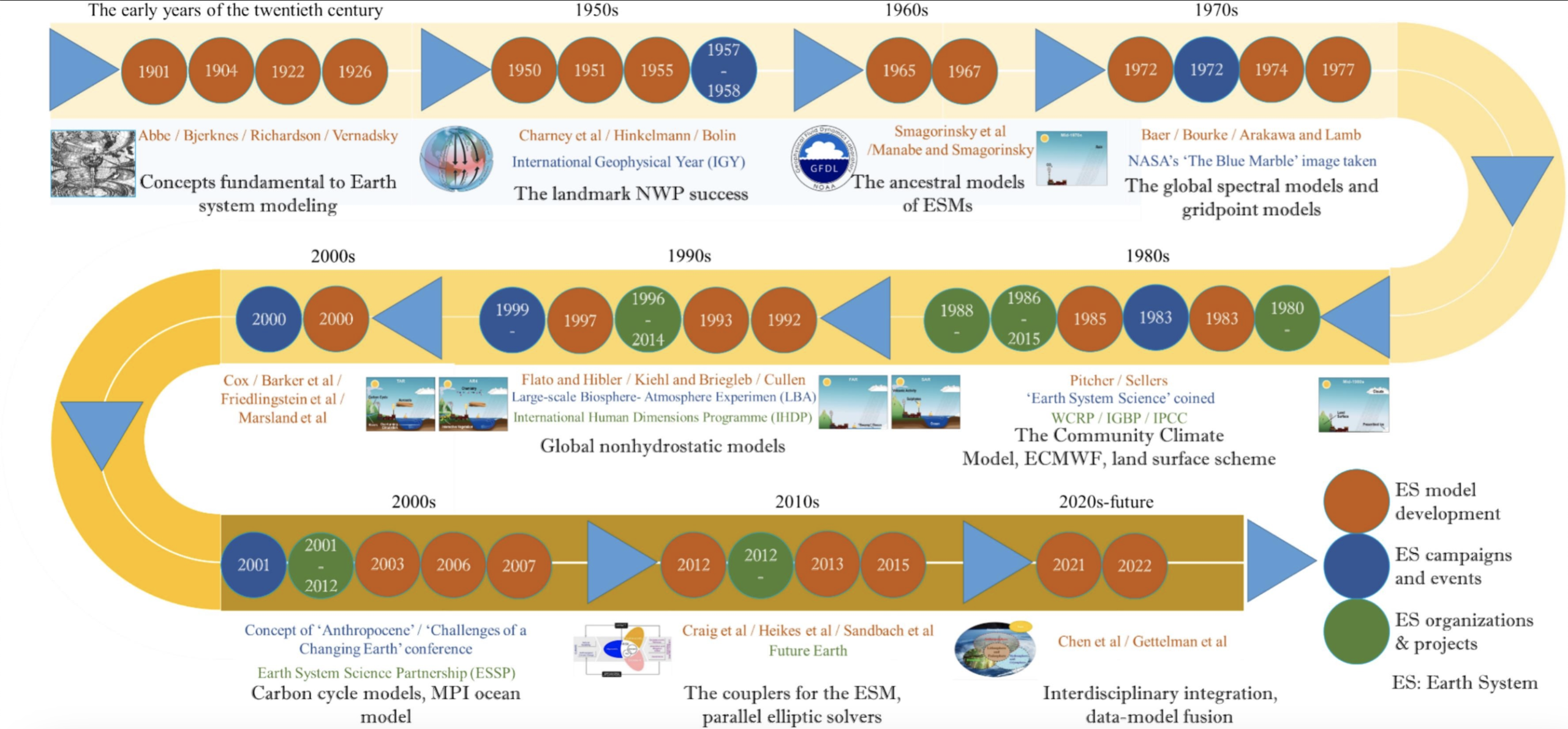
Evolution and prospects of Earth system models: Challenges and opportunities, Earth-Science Reviews, Volume 260, 2025, 104986, ISSN 0012-8252, https://doi.org/10.1016/j.earscirev.2024.104986.
Where the science and diplomacy can lead us
The 2026 GESDA Science Breakthrough Radar®, distilling the insights of 2,390 leading researchers from 89 countries, describes Earth system modeling as a transition from isolated climate simulations toward an integrated paradigm that treats the planet as a complex, self-regulating whole.
Key Radar references:
→Earth Systems Modeling — Researchers seeking to understand environmental shifts have incorporated ever more components of the Earth system into their models. This is because of a growing understanding of the significance of the interactions between elements of the Earth system: oceans, atmosphere, land, cryosphere and biosphere.
→3.2.1 Modeling of Feedbacks in the Earth System — Modeling Earth’s climate with any fidelity requires considering its interacting network of feedback loops.
→3.2.2 Tipping Element Modeling and Forecasting — An important outcome of Earth systems modeling is the demonstration of sudden, irreversible changes that may occur with relatively small changes in climatic elements.
→3.2.3 Interactions Between Earth Systems — The various Earth systems cannot be fully understood in isolation